August 18, 1996
Puerto Cabello,
Venezuela
Dear Friends,
It seems that I do a lot of my correspondence in the wee hours of the morning a night
or two before leaving for our next destination. This is no exception. It's a very warm
night in Puerto Cabello. I'm sitting in the cockpit accompanied by the soft sounds of the
surf on the nearby beach and a gentle breeze. Tomorrow, after a visit to the Banco
Consolidado, we will spend the day reprovisioning for another two weeks in the Out Islands
before heading east to Carenaro. This past month has been filled with interesting and
exciting adventures including a five day vacation. But, let me start where I left off in
my last letter…
Once the provisioning is completed, water, propane and fuel tanks filled and all the
'at anchor/dock' loose items stowed, the only thing left before the anchor is lifted is
the weather report. In the Caribbean there are many sources of weather information. The
most common being the radio 'Nets'. Many cruisers tune into 'David's weather net' on 8104
Mhz SSB at 8:40am. David, from his boat 'Mystine' currently at Rodney Bay St. Lucia give a
full weather report covering the Caribbean as well as individual weather forecasts for
boats preparing for a passage. Weather is also available on the various HAM nets.
Regardless where you get it, weather in the Caribbean in hurricane season is 'Tropical
Waves' with the key words being 'convection' and 'rotation'. The 'waves' come off the
African coast and are tracked across the Atlantic moving four to five degrees of longitude
each day. The more convection, the deeper the low which means higher wind speeds and
bigger seas. If the system begins to rotate it then has the potential of getting it's own
name and scaring the wits out of anyone north of 12 degrees N latitude. Tropical waves
also affect the direction of the trade winds. Minor waves will cause the trade winds to
back to the north east as they approach and to the south east as they pass. The stronger
the wave the more influence it will have on the wind and therefore the seas and therefore
where you anchor and when you make a passage. I did not mean this to be a weather lesson
but next to the current exchange rate and the price of beer, the location of the Tropical
waves is foremost in a cruiser's mind.
As we prepared to leave Puerto Cabello for Las Aves I listened to David's weather
forecasts and dutifully recorded the location and strength of each wave to the east of us.
Las Aves are slightly east of due north from Puerto Cabello. I wanted to take advantage of
the more southerly direction of the wind as and just after a wave passes to give us more
of a reach (wind more to the side of the boat for my non-sailing friends) to the islands.
We left Puerto Cabello at 6:00pm with a strong wave expected to pass through about
midnight. We motored east in calm winds and seas along the coast where the land effect
minimizes the effects of the waves. At midnight we headed north to Sotovento the western
most of the Las Aves islands. By 3:00 am the wind had picked up to 15 knots from the south
west! By 4:00 am rain reduced visibility severely and the wind had increased to 20 knots.
At 6:00am we were surfing down 15 foot waves with a 25 to 30 knot wind from the south. At
8:30am, 22 miles south of Barlevento the eastern most of the islands, David reported that
the 'Wave' had increased overnight and was now Tropical Storm Caesar which was expected to
be 'Hurricane Caesar' within the next 24 hours!
We arrived in Barlevento around noon very tired but otherwise in good shape (I altered
course during the night to give us a better angle on the waves and as Barlevento offered
better protection from southerly seas). We rounded the point of Isla Sur. Within the
protection of the barrier reef to the east and the mangrove island to the south and
dropped our anchor in 15 feet of clear, calm water. The contrast of this placid pool of
water in the midst of the raging winds and seas was an incredible experience. We slept
away the rest of the day while baby Caesar moved into the south western Caribbean,
intensified and became Hurricane Caesar later the next day
The next morning the skies had cleared. The bright sun reflecting off the sand and
coral bottom of the reef and it's protected lagoon displayed a thousand shades of blue
from the almost white of the shoals to the deep blue of the ocean depths just the other
side of the reef. Outside the reef the seas were still large and broke with towering
plumes of spray on the 30 to 50 feet of coral that protected lagoon while the wind swept
through the anchorage unabated. The 15 to 20 knot trade winds provided a welcome cooling
relief from the hot sun. Beneath us schools of fish swam in circles in the shade of the
hull. As the newest arrival to join the 4 other boats in the anchorage we seemed to draw
the interest of numerous Booby birds who nest in the nearby mangroves. On their fishing
expeditions many would fly by the boat and hang almost motionless on the strong breeze,
cock their heads sideways to get a look at their new neighbors under the sun awning.
Later that day we returned the visit by dingy. Motoring and rowing into the small
shallow pools amongst the mangrove we were able to witness a very close range the
pelicans, boobies and cormorants expert fishing techniques. As we toured inner coastline
of the small island we stopped to say hello to the other cruisers. The people you meet
along the way is a very big part of what makes this lifestyle so appealing. One of the
boats we visited was 'Iduna III' from Toronto. Peter and Erika have been cruising Europe
and the Caribbean for 8 years. During a most enjoyable 'Happy Hour' Peter agreed to teach
me how to spear and clean fish.
The next morning at 10:00am Peter and I headed for the reef. The coral reef surrounding
Barlovento is a spectacular underwater city. The water on the inside edge is 4 to 6 feet
deep with a sand bottom. The huge growths of brain coral are like blocks of building with
thousands of finned dwellers. Between the coral blocks the sandy paths form a maze of
streets and alleys. Peter helped me to identify the edible, good and great tasting fish
and the fish and corals to avoid. Before long I was snorkeling through the watery city
searching the nooks and crannies for lobster and black grouper. Let me assure you it's not
as easy as it looks. The fish have a very definite advantage. The Bahamian sling is
basically a stick with a sharp point at one end and an elastic loop at the other. By
placing the elastic loop between you thumb and forefinger and pulling the spear back to
stretch the elastic when you release your grip the spear will shoot forward. Aiming it is
another matter entirely! On my first day out I killed enough sand to make a small beach.
With a lot of practice I was able to get much closer to where the fish was. Therein lies
the next difficulty, the fish don't wait around while you get ready to invite them to
dinner. They scoot away much faster than I can swim and they fit through openings in the
coral that no amount of dieting would enable me to fit through. After 6 hours I returned
to the dingy empty handed. Peter had caught the largest lobster I've ever seen along with
2 smaller lobster and a couple a mid size black grouper! Tomorrow's lesson would include
more than just specie identification!
Over the next week Peter and I went to the reef almost every day. I was always amazed
at how quickly the time passed, 5 or 6 hours would pass in what seemed like minutes. The
reef is so alive and every channel you follow leads to a new and interesting community. In
my travels I came nose to nose with a very large (12-14 foot) nurse shark and several 6
foot barracuda. Apparently neither are dangerous. I didn't stick around long enough to
test the theory (I now understand how those smaller fish can swim so fast). The barracuda
were a common sight. They would swim 10 to 15 feet behind and just watch. We would move to
a new location to fish when more than one barracuda joined the party. I never really got
used to them and to add to my other problems catching fish I was constantly looking over
my shoulder. However, I did catch and clean a few fish during the week and let me tell
you, fresh black grouper broiled to perfection can compete with anything land or sea can
provide for the dinner plate!
One of the more difficult parts of cruising is the all too frequent 'good bye's that
must be said to wonderful friends like Peter and Erika. At the end of the week 'Iduna III'
was headed to the northern part of Barlevento out on the reef to do some more fishing and
'Pirate Jenny' was off to see the other island group in Las Aves, Sotovento. So it was
with anchor raised and to the sound of Peter's conch shell horn and a small tug at the
heart strings, we circled to wave our last good bye's and headed west to Sotovento.
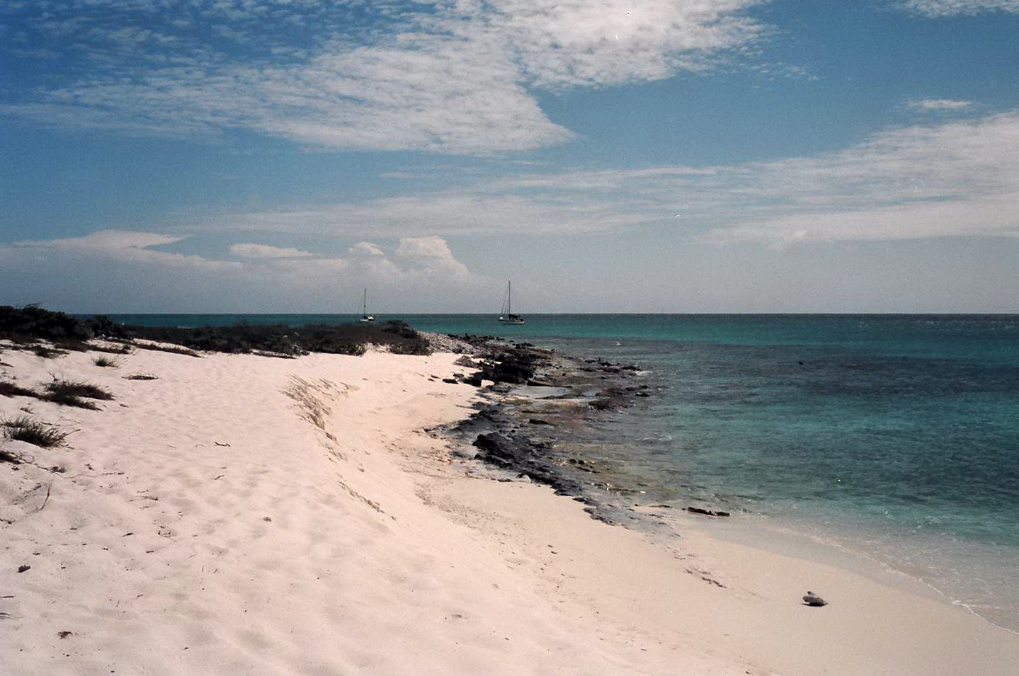
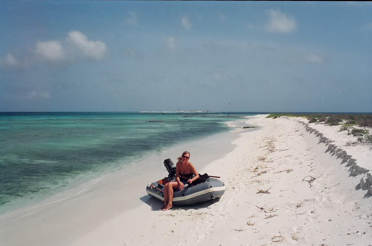
Beach on Round Island, Sotovento, Las Aves
Ev on Long Island Beach Sotovento
Sotovento is quite different to Barlevento, While both are surrounded by a large
barrier reef, Sotovento has several small white sand islands on it's western edge. I
remembered, with a smile, sitting at my dining room table last February the day my charts
arrived. It was freezing cold and snowing outside and the wind howling. As I paged through
the charts I stopped at the chart for Las Aves. There was a small island surrounded by
coral with the notation of "Palm tree" and "fisherman's hut'. I remember
thinking 'that's where I want to be'. We dropped anchor just 50 yards off the white sand
beach right in front of that palm tree. What a wonderful feeling.
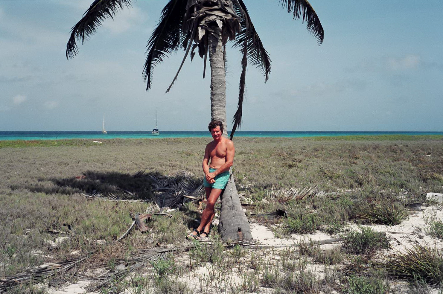
Bart with lone palm tree on Long Island, Sotovento
We spent a week in Sotovento enjoying the clear water, walking along the pristine
beaches and sitting under that palm tree. On several nights I would sit on deck with my
tea and stare with renewed amazement at a sky so filled with stars. With no moon and no
city lights to obscure them the stars and planets were a brilliant canopy of light from
horizon to horizon in every direction. Low on the horizon (12 degrees) I found Polaris and
recalled many evenings on the Ottawa River looking at that same star (at 43 degrees) and
thought of my many friends anchored at Phiney's Point that very evening. I wished I could
magically transport them all to share this beautiful anchorage with me in Sotovento.
We had intended to head east to Los Roques from Las Aves but had gotten some unpleasant
news about a Canadian couple from Halifax we had met in Bonaire. They had been anchored in
the lagoon by Tucacus and while in town their boat was robbed. They lost all their
electronics, dive equipment, even food and clothing. Unfortunately paradise has it's bad
elements too. We radioed them through other friends in Puerto Cabello and offered to meet
them and loan them a handheld VHF and spare GPS and travel with them to Puerto La Cruz
where they could replace these and other essential equipment.
Our trip back to Puerto Cabello was one of those magic times under sail! We left
Sotovento at 5:30pm with 15 to 20 knot winds on the beam and 4 to 5 foot seas. We sailed
all night under full sail at times reaching 8.5 knots! Conditions held right up to 15
miles from Puerto Cabello where the wind dropped and we had to motor. In all we traveled
96 miles in 15 hours, an average of 6.5 Knots! We had clear skies all night. The sparkle
of the phosphorescent algae in the water vying with the stars above to provide the best
light show.
Back in Puerto Cabello we felt like natives. We have been here long enough to know the
town well and made the acquaintance of many shop keepers, waiters and the marina
personnel. After a few days in town and discussions with Tom and Judy (the Canadians from
Halifax on their boat 'Syncronicity') we decided a holiday to the mountains was in order.
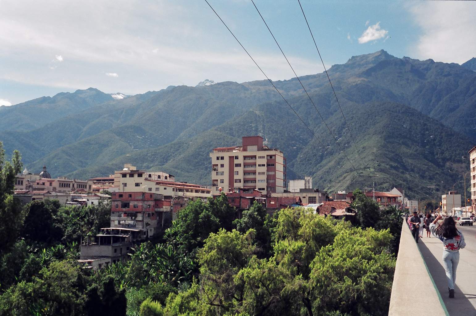
Venezuela has one of the most diverse topographies of any country I know of. From the
Jungles of the Amazon and Orinoco rivers to the central savanna, a plateau thousands of
feet above sea level, the tropical coastline and out islands, the coastal mountains and
agricultural valleys to the lofty peaks of the Andes. We decided on a 5 day trip to
Merida, a beautiful small city high in the Andes.
Pico Bolivar, Los Andies - Merida, Venezuela
We left Puerto Cabello by local bus for Valencia and spent the afternoon window
shopping on Calle Bolivar, the main street. From the bus terminal we boarded the overnight
bus to Merida at 8:00pm. The modern air conditioned bus was a treat from the very warm
humid temperatures of the Caribbean coast. By midnight and several thousand feet higher
the bus was a deep freeze. We arrived in Merida at 7:00am just after sunrise. Stepping out
of the bus the towering peaks of the Andes were a very impressive sight. We found a small,
clean and very inexpensive (2,000 b / person / night (about $4.00)) hotel. After a shower
and breakfast of fresh juice, coffee con leche and empanadas con queso (a corn pastry
filled with cheese), we spoke to an English tour guide to arrange a trip into the
mountains for the following day.
We spent the rest of the day exploring Merida. The city is nestled in the mountains
beside Pico Bolivar, the highest mountain in Venezuela. We walked the clean streets and
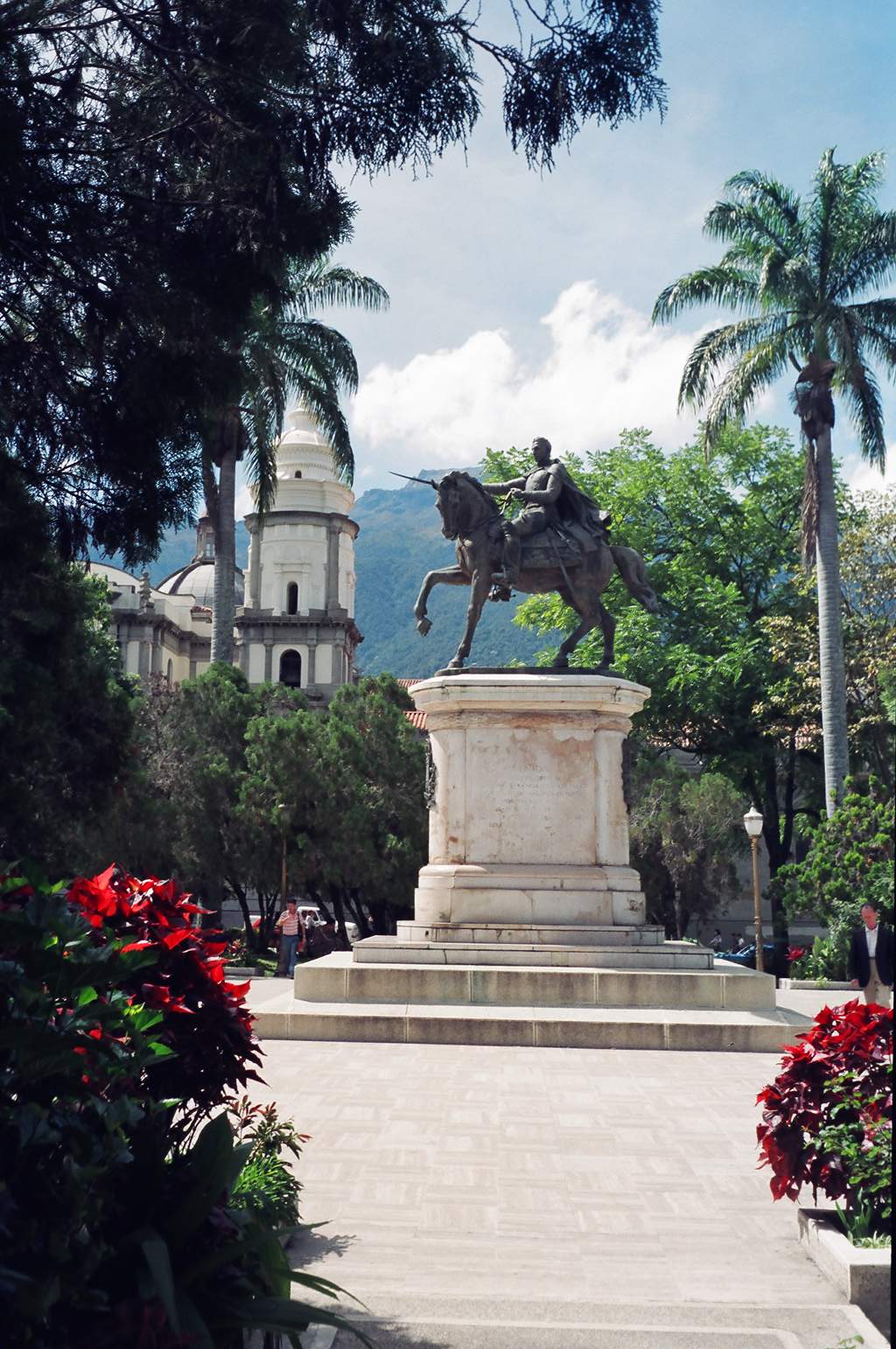
were greeted by very friendly, proud Venezuelans. We went to the Plaza Bolivar ( the
centre square of every city, town, village and hamlet in Venezuela) where we admired the
work of local artisans.
Plaza Bolivar - Merida
Our tour began at 7:00am Venezuelan time (8:15am), Cyril, Gorge and his son Daniel
picked us up in their mini van and we headed north towards Pico El Aquila, a mountain pass
at 13,250 feet above our boats, safely tied in the Marina. Merida lies in the valley at
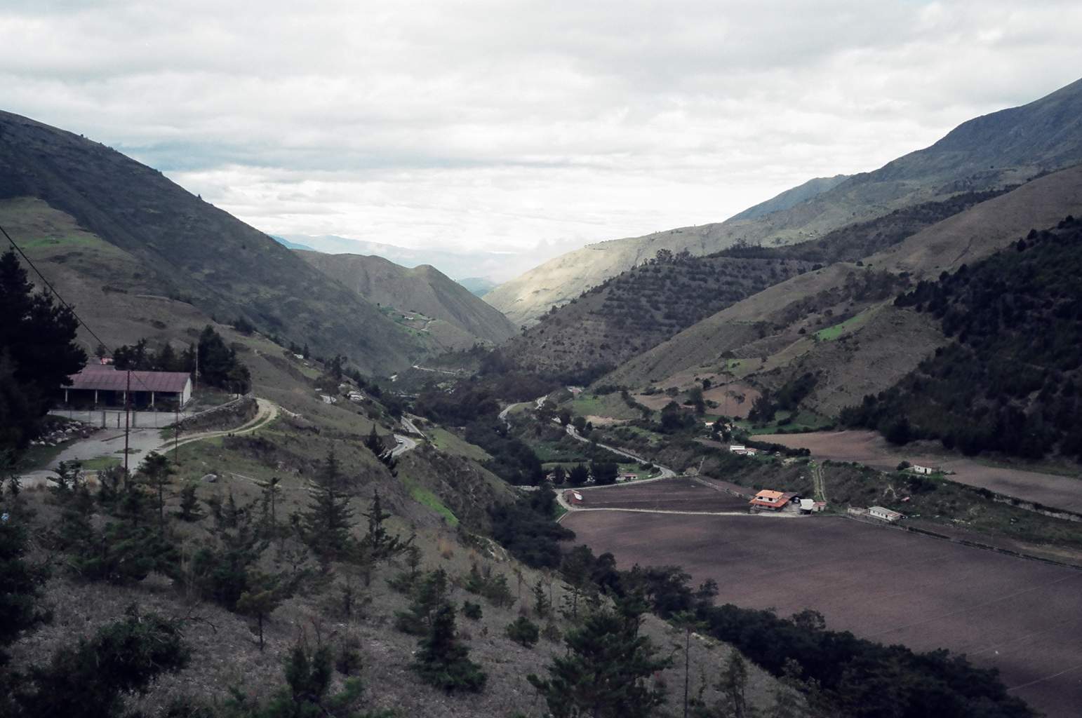
5,150 feet. The long climb took us past several picturesque small towns. As the road wound
back and forth up the steep slopes the views of the valley below were breathtaking. We
passed fields of potatoes, garlic and artichoke all worked by hand. We watched as mountain
farmers ploughed their fields with oxen and cattle grazed on hillsides that were
remarkable close to vertical. Our tour took us through Apertaderos where we visited a
mountain observatory where 5 giant telescopes searched the heavens through the thin
atmosphere. We visited a biological site where scientists are attempting to repopulate the
Andes with the giant condor declared extinct 10 years ago. Due to their work there are now
just over 10 of these magnificent birds once again soaring from the highest peaks of the
Andes. We were able to see a male and female condor in a very large enclosure that
scientists hoped would soon be a nursery.
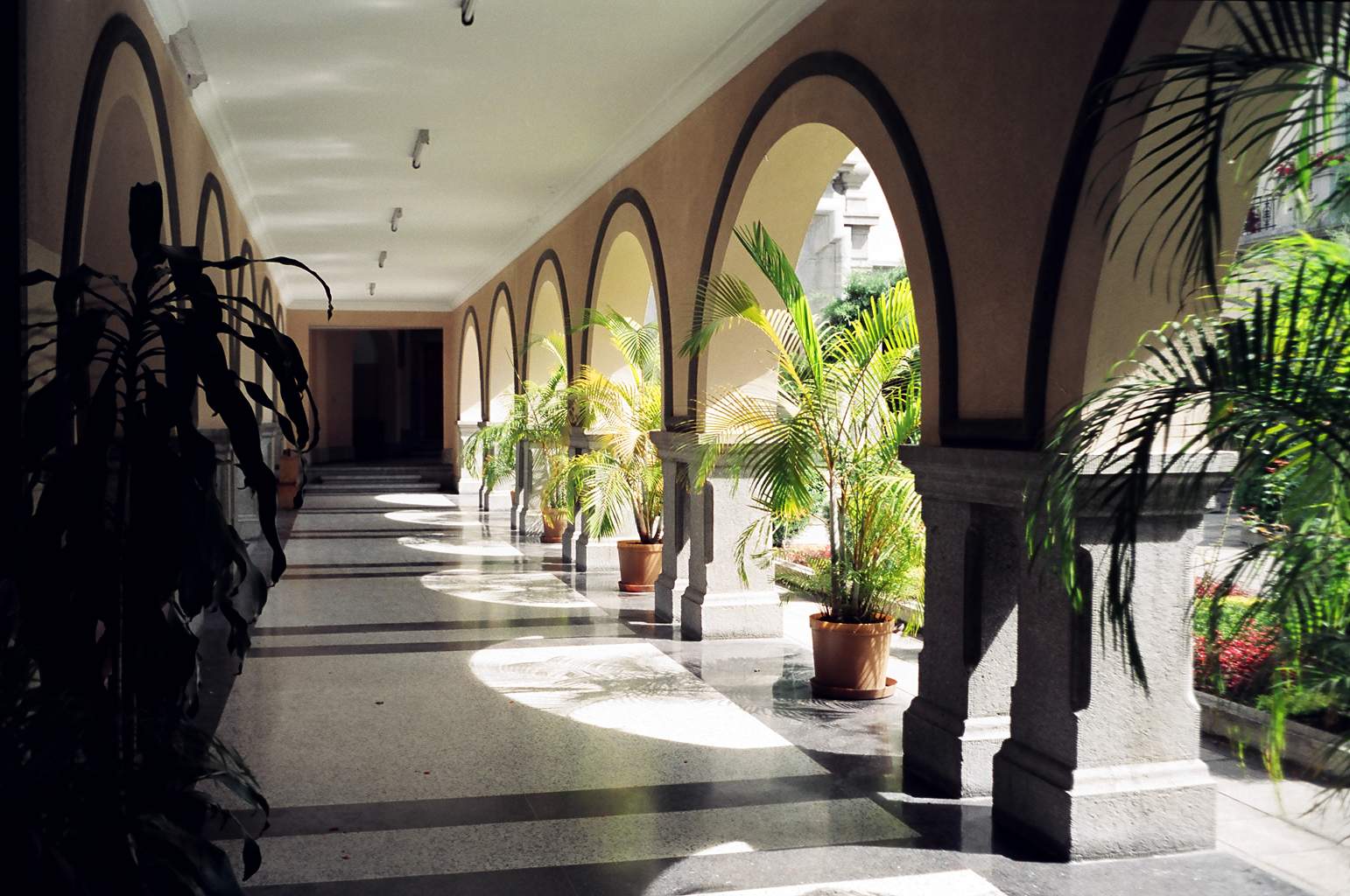
University courtyard, Merida, Venezuela
A short distance from the mountain pass we rode horses along treacherous mountain paths
the 3km distance to the Laguna Negra, a lake situated high atop a mountain. The altitude
was such that we were constantly in the clouds and visibility was reduced to only several
yards. Still an incredible experience! The air was thin, clean and just above freezing.
Quite a contrast to the temperatures we have experienced in the last few months.
The next day we continued down from Pico El Aquila through Chachopo to Timotes. From the pass to Timotes is a drop of almost 10,000 feet over a distance of 30 km (as the eagle flies). The road down is a series of hundreds of hairpin turns with magnificent vistas of the valley far below.
In Timotes we stayed in a beautiful small Posada and on our evening walk through the
Plaza Bolivar met some of the friendliest native Venezuelans who were clearly intrigued by
the white visitors to their village.
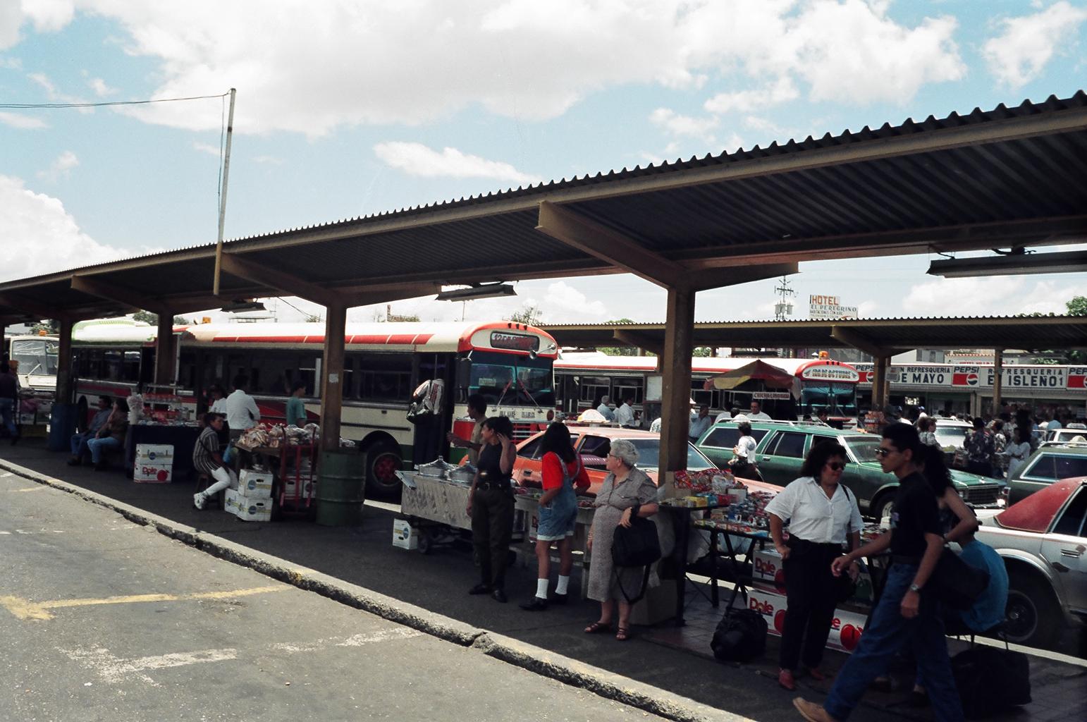
The last day of our trip was spent returning to Puerto Cabello on the local busses. In
Venezuela a bus ride is an experience. Busses are decorated with the destinations or home
towns of the bus and in some cases the drivers nickname painted in the brightest of
colours on the outside of the bus. Inside the bus passengers bounce about with the drivers
favorite music blaring while the fare collector hangs out the usually open door calling
the destination in hopes to attract more customers. Finding the bus to Valencia one need
only listen for the shout of "Valenci, Valenci, Valencia". Our 7 hour trip back
to Puerto Cabello took us along a good tree covered highway through lush agricultural
valleys to music that would stir the heart of a bullfighter with both bus and speakers
pushed just beyond their limits.
Bus terminal in Valera, Venezuela
Returning to the hot humid air of the Caribbean coast after our mountain holiday we are
looking forward to the refreshing trade winds and cool clear water of the out islands of
Los Roques. We will spend the next week or so in Los Roques then sail to Carenero and La
Tortugas before arriving in Puerto La Cruz around the middle of September. I'm sure I will
have lots more to tell you by then.
Best wishes to all.