 Haitian
sailing vessel heading home
Haitian
sailing vessel heading homeApril 23rd, 1998
Nassau, Bahamas
Dear Friends,
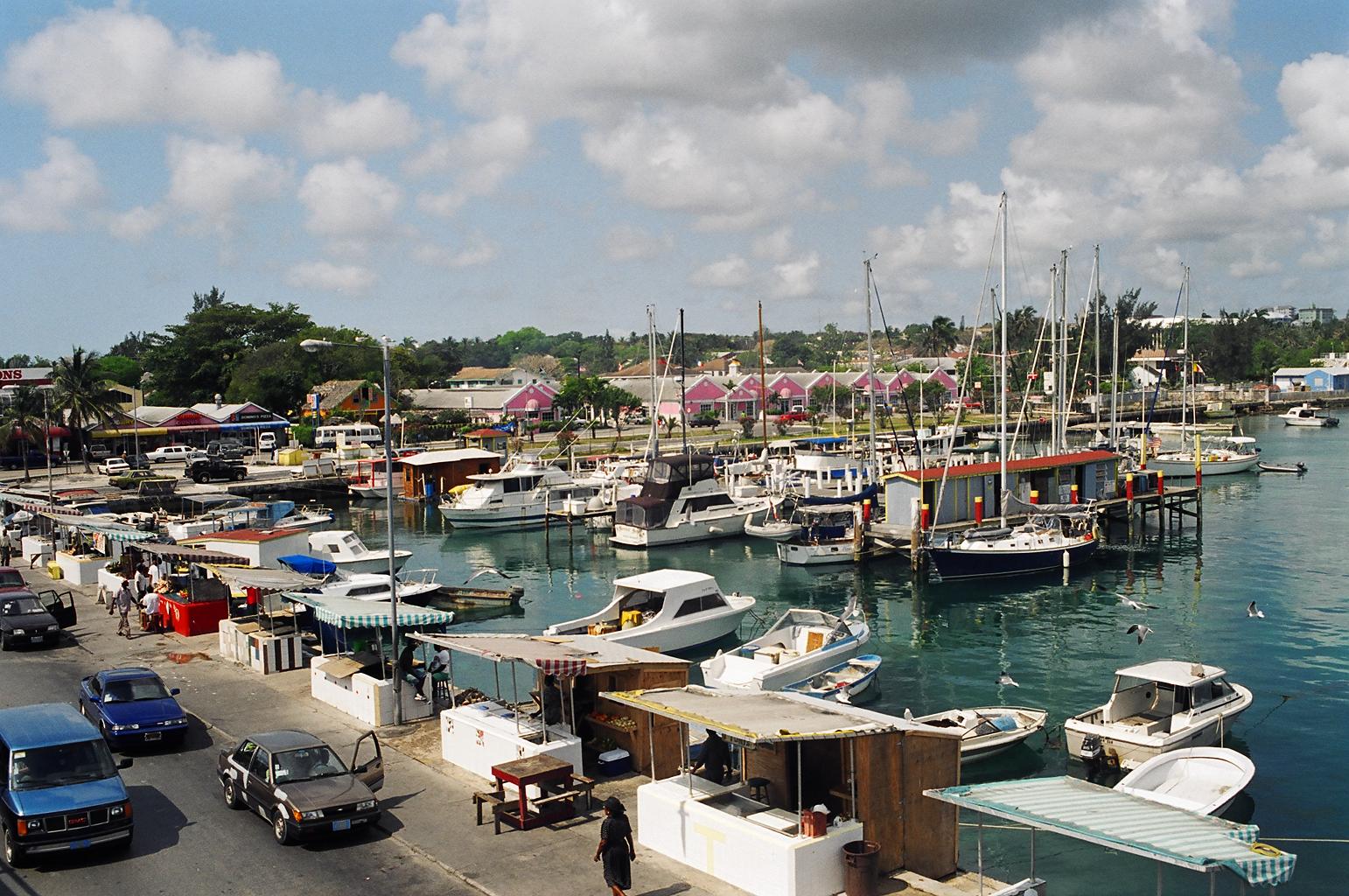
This morning 'Pirate Jenny' sits quietly in a slip at East Bay Marina in the center of Nassau. All around us are the sights, sounds and smells of a busy city. A few metres astern are the vendors of Potters Cay with their booths offering fish, fresh vegetables and conch. The constant traffic over the Paradise Island bridge competes with the squawking seagulls to make the loudest sounds. There is a light but cool breeze and it looks as if it could rain a bit during the day. Under the boat, through 10 feet of clear water we can easily identify the old tires, boat parts, cans, bottles, empty conch shells and other assorted junk accumulating on the harbour bottom for the last several hundred years. Small fish dart in and out of old broken pipes that they have claimed for their own. There are people and the sound of voices everywhere. All of this is quite a contrast to our last few weeks!
The morning after completing my last letter it appeared we had a short weather window to head for the Turks and Caicos Islands, 100 miles north of Luperon. We quickly hauled anchor and left the harbour (this time avoiding the sand bars and mud banks). We sailed all day in beautiful conditions, small seas and 12 knots of wind on the beam. Our destination was Sand Cay on the eastern side of the Caicos Bank. This Cay has an open sand bay that can safely be approached at night. At about 11:00 pm and 15 miles south of Sand Cay the wind abruptly turned from east to north and increased to 20 then 25 knots! Well, so much for Sand Cay. As always we had an alternative planned and we changed course heading west to a small island on the south side of the banks about 50 miles from where we were. We sailed through the night and into a large cold front that was not supposed to be that far west. The winds remained strong all night but sailing in the lee of the banks gave us small seas and in all not an unpleasant passage.
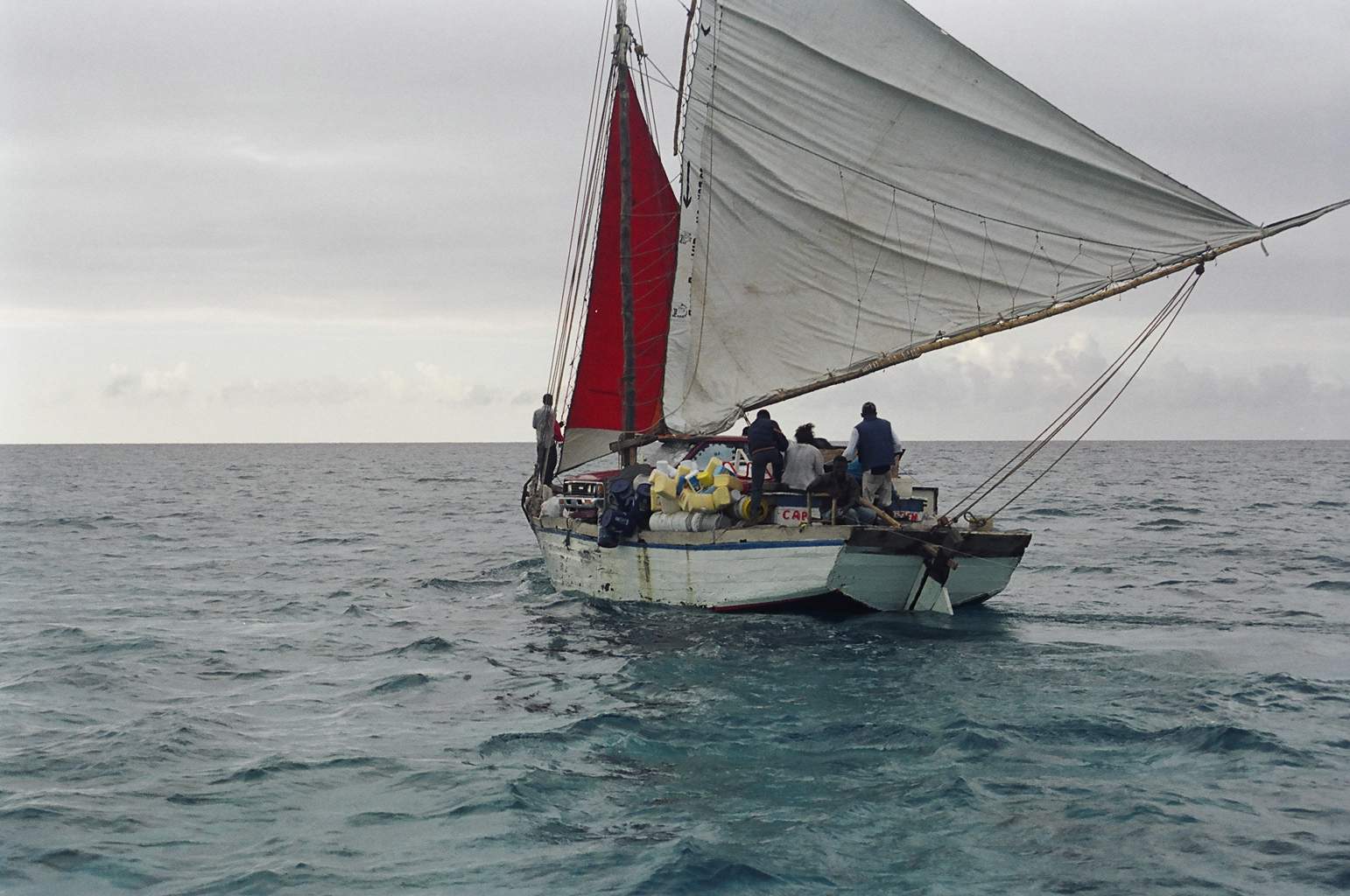
We arrived shortly after dawn the next morning and anchored in the lee of French Cay with no other land in sight. The skies remained overcast and a cool rain began to fall. We spent a quiet day resting snuggled up under blankets that had been in storage since the Chesapeake two years ago. The following morning while eating breakfast and listening to the weather we watched a Hatian sailing vessel appear from across the banks and head south on their way home. The open wooden vessel was no more than 35 feet long with three fellows, a woman and two children aboard. These small vessels travel regularly to the Turks and Caicos with fresh vegetables and return with whatever goods they can buy cheaply or scrounge from the island dump. As the vessel passed within a boat length of our stern the friendly helmsman said 'good morning'. I was almost too surprised to speak. I sat open mouthed and stared as a bright red Toyota pickup truck parked amidships, overhanging on both sides, passed slowly by. I'm afraid the picture is not great as it was an afterthought. But, this you have to see to believe.
Haitian
sailing vessel heading home
We did not have very detailed charts for the Turks and Caicos so we sailed 20 miles west to the ship channel which was reported to be clear sand with no coral heads and a depth of 12 to 20 feet. From this point we had to motor to the northeast about 12 miles to the anchorage at Sapadillo Bay. Though seas do not build very high on the banks the 30 some hours of 25 knot winds had built a 3 foot chop over the bank. Between that, the 25 knots of wind on the bow and an ebbing tide creating a two knot current against us it was the longest 12 miles I can ever remember. In the end we had to motor sail the distance short tacking in the channel for close to five hours before we finally dropped the anchor. I had very little good to say about anything at that point so, had a quick dinner and went to bed.
Things looked much better the next morning. We where anchored in a comfortable bay tucked into the south shore of Provodenciales (known locally as Provo). The bottom is good deep white sand and the water crystal clear. We checked in with customs then went for a look at the town. The south side of the island has the commercial port and a few housing developments. The waterfront most of the way around the islands is dotted with very expensive homes and condo projects. The northern side of the island is a large sweeping curve of pure white sand. Though early visitors must have seen it as pure gold as the entire north coast is lined with hotels and resorts. Town however, is little more than a grocery store, gas station and two banks.
We had hoped to make our stay a very short one but El Nino was doing his worst. Florida was experiencing close to hurricane strength winds as cold fronts seemed to line up to have there turn at it. The next week brought constant winds of 25 to 30 knots and seas of 10 to 12 feet between Provo and Georgetown. Finally with only 4 days left till my brother Lane and family were to arrive in Georgetown (still 210 miles away) we had to make a phone call. For the first time we could not make it to meet our visitors. Fortunately Lane was able to make some changes and by the next day had tickets in hand for Provo. Finally, the pressure was off. We bought a detailed chart of the island and asked around about things to see and do.
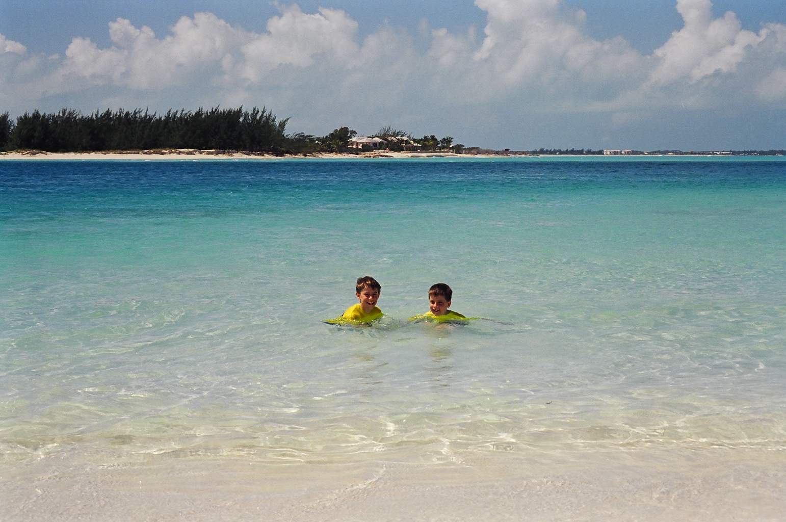 Evan
and Brant enjoying Provo's crystal clear waters
Evan
and Brant enjoying Provo's crystal clear waters
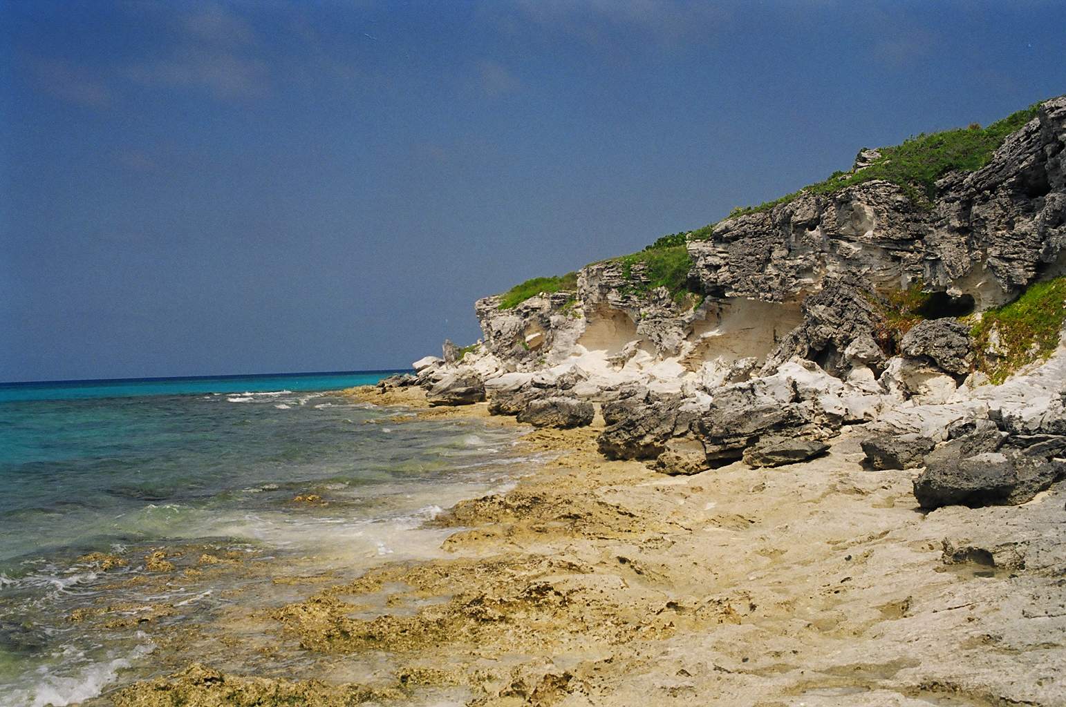
It quickly became apparent that the north coast was the place to be so we left Sapadillo bay and sailed around the island. The north coast has a continuous reef running the full length of Provo and the other Caicos Islands. Once tucked in behind the reef the water was calm and clear with a maze of beautiful, healthy coral heads to snorkel on and clear white sand trails to follow in safety.
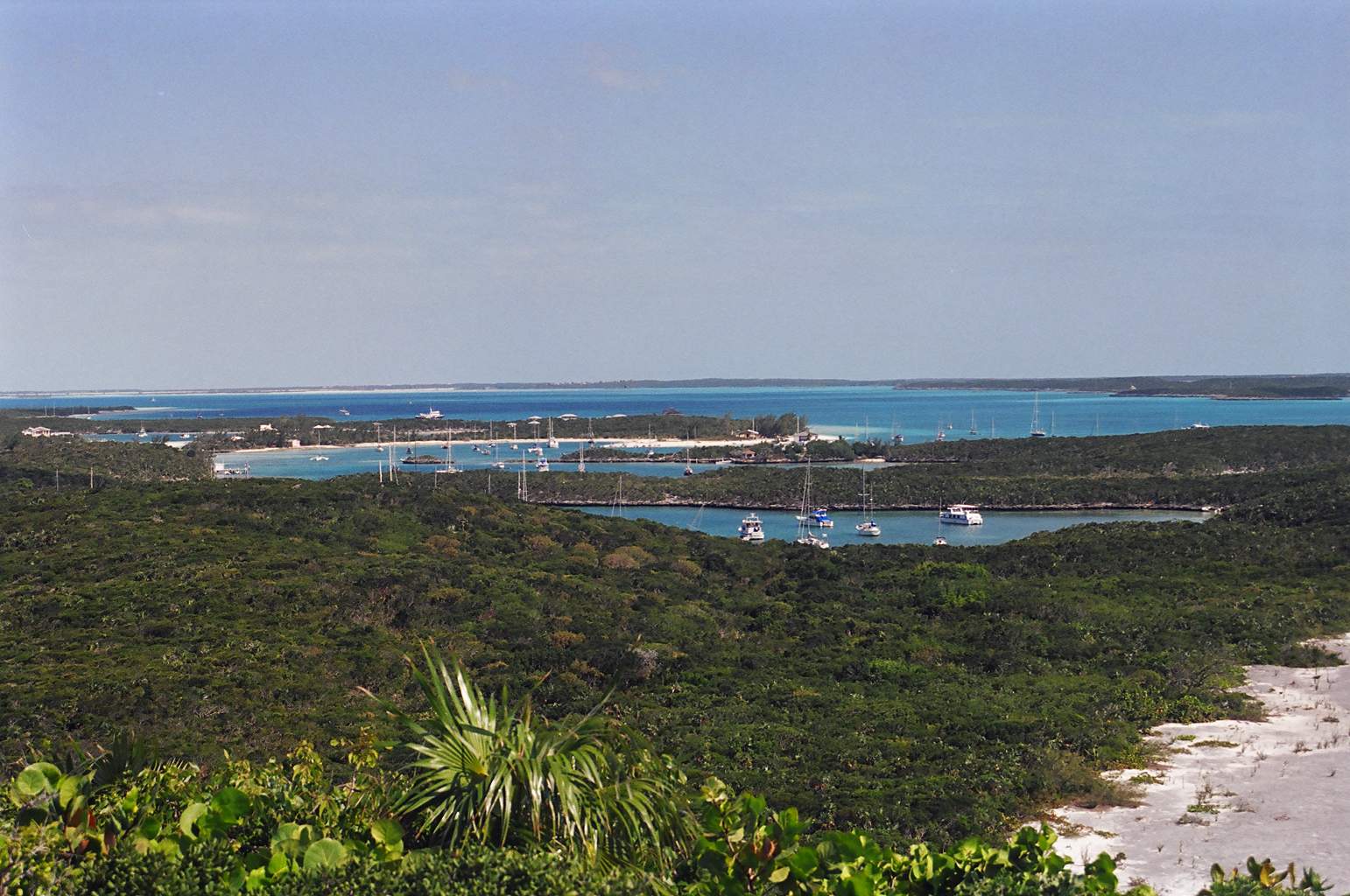
We did not sail much in the next two weeks. We anchored in a picture perfect spot between Provo and several smaller islands off the northeast point. We were very protected from all weather and were a short dinghy ride to pristine beaches, the conch farm and Little Water Cay which is home to some very sociable iguana. We also had the honour of meeting JoJo, a wild dolphin that has, for the last 18 years, greeted and played with visitors to Provo. JoJo spent a good two hours swimming with us, jumping and playing alongside the boat. To say my nephews Evan and Brant were thrilled is an understatement.
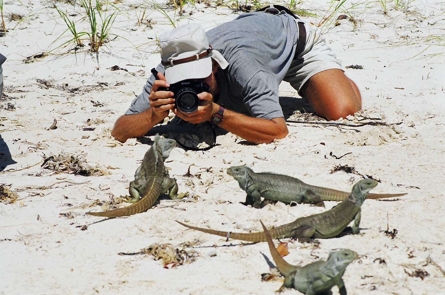
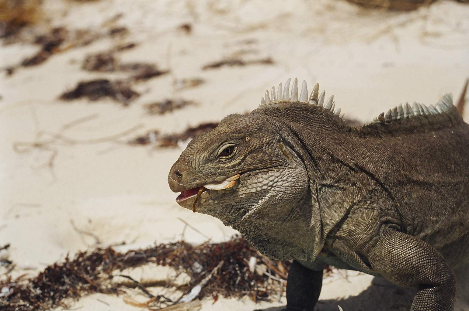 A
resident of Little Water Cay
A
resident of Little Water Cay
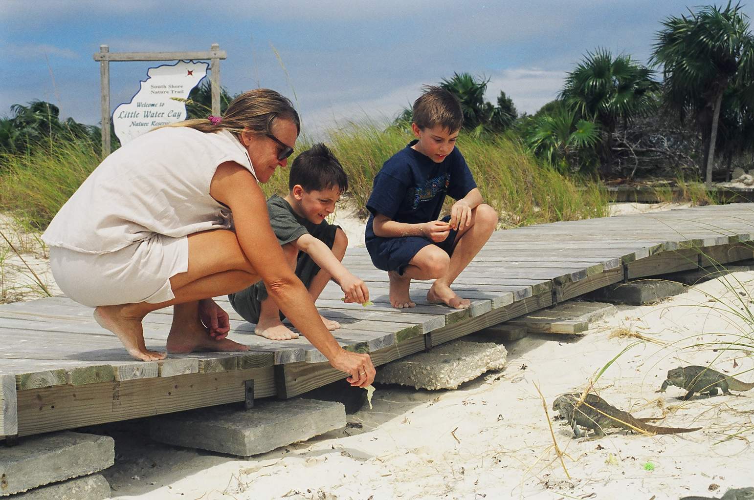 Evelyn,
are you sure they're vegetarians?
Evelyn,
are you sure they're vegetarians?
The Turks and Caicos seem to be little more than a stepping stone for most cruising yachts. Aside from those 'in transit' in Sapadillo bay we saw only a half dozen other sailboats. Having spent the better part of a month around the island we found that it is a very interesting place. Everything you could need is available, it just takes a bit of looking but, there are very good grocery stores, hardware, auto parts and marine stores, a couple of good marinas, even a haul out yard if needed. There is excellent diving and beaches with your choice of wall to wall sun umbrellas or total seclusion. There are also several good spots to anchor. Although it is a bit expensive by DR or US standards, prices and selection were quite reasonable and as we later found considerably better then in the Bahamas.
Four adults and two whirl winds on a 32 foot boat for two weeks can be a bit crowded. But, it seemed to take very little time this year for us all to adapt and though the boat was a constant tumble of clothes, suitcases, games, books and people we had a ball! In fact, Ole and Beth had caught up with us and anchored nearby so often there was eight for dinner. We even had a couple of meals of fresh conch thanks to the kids finding them and Ole cleaning them. Time flies when you're having fun and all to soon our guests were headed home.
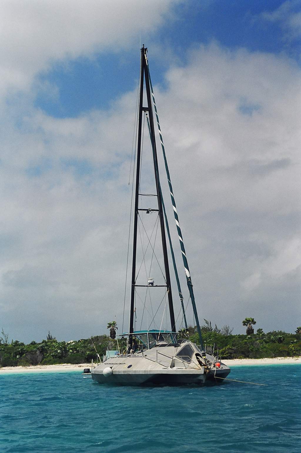 Custom
designed trimaran 'Aquanaut' (glass bottom sailboat)
Custom
designed trimaran 'Aquanaut' (glass bottom sailboat)
As Lane and family taxied to the airport we prepared for our departure. We had perfect conditions for our next hop to Mayaguana, the most southeasterly island of the Bahamas. We sailed the 35 miles on a calm sea with a gentle breeze on the beam. On checking into the Bahamas on this small, sparsely populated island we were greeted with warm friendly smiles and immediately felt welcome. A weak cold front was to pass through in the next few days which would bring the wind to the northwest, the exact direction we had to sail, so again we waited for the weather. Four days later the front had passed and we once again had excellent conditions. We decided to sail directly to Conception Island 135 miles away. We left Mayaguana at first light and had a wonderful day and night under clear skies with good winds and seas.
Conception Island is a part of the Bahamas Land and Sea Park. It's only inhabitants are the birds, lizards and fish. The island has several beautiful coral sand beaches and has numerous healthy reefs extending five miles to the north and two miles to the south. We spent several days enjoying the beaches and snorkeling on the coral reefs. The Bahamian waters are home to numerous species of shark. We had occasion to meet one face to face when Ole was fishing and had a reef shark take half his fish right off the line as he reeled it in. Later thanks to another cruiser in the anchorage we had some tasty shark steaks for dinner. I did not see any sharks while snorkeling and believe me I was keeping a very sharp eye out, but they are certainly around and I would highly recommend you save your moonlight swims for the hotel pool…. Then again maybe the hotel bathtub (I'll explain in a moment).
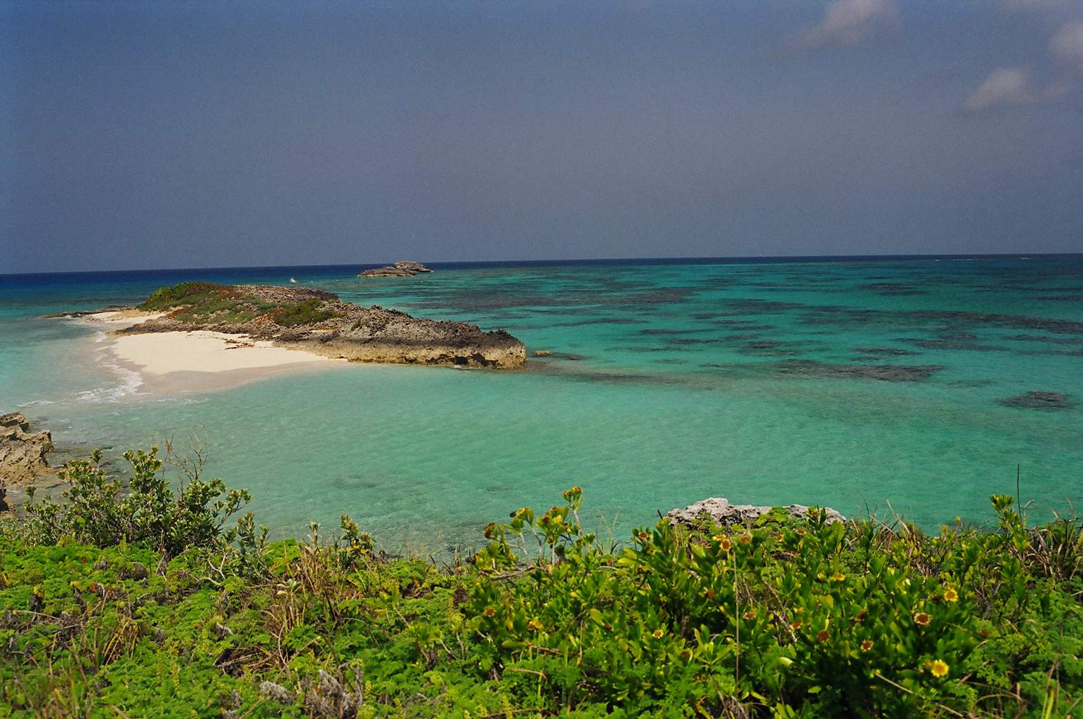 Reef
off the northern tip of Conception Island
Reef
off the northern tip of Conception Island
Our next stop was Georgetown. Located at the southern end of the Exuma island chain, Georgetown has long been the portal to the Caribbean. Many cruisers who prefer the more protected waters of the banks stop in here to wait out the coldest part of winter then return north. For those who would venture to the south along the "Thorny Path" Georgetown is the start point of the 'run for cover', 'wait for weather' transit to Puerto Rico. The town itself is small with only a few restaurants, one grocery store and one marine store. It is very expensive, by far the most expensive we have found on our cruise. However, Georgetown still draws over 400 boats for the March cruisers regatta and almost as many for the Family Islands Regatta in April.
The waters near the town are almost land locked with Stocking Island to the east and Great Exuma Island to the west the10 mile by 1 mile stretch is only open to the Exuma sound at either end through narrow channels. Once inside the waters are very protected and comfortable anchorages can be found in every nook and cranny. Stocking Island itself has several small circular pools interconnected by shallow, narrow passages. It amazed me that boats with considerable draft had found a way into these pools. We spent only two days in Georgetown but very much enjoyed the beaches and hiking on Stocking Island.
Entering the harbour area from the sound can be a bit of a white-knuckle experience. I would recommend that it only be done in a westerly wind or in very calm conditions. In other conditions it is referred to as "The Rage". We entered at the southeastern cut in 20 knot easterly winds with a moderate swell (4-6 feet) from the north east. As we reached the first turn in the entrance where the channel parallels the edge of the bank behind a few outcroppings of rock, we experienced the most frightening conditions we have seen in our two years. For about 2 miles, until we reached the lee of Guana Cay, we were surrounded by 12 to 15 foot breaking seas. The narrow channel with coral islands to the west and rocky, semi submerged shoals to the east left very little room for maneuvering. Evelyn claims I lost all my tan in that 15 minute passage. Apparently over the years several boats have broached and been lost on the rocks in these cuts.
We left through the northern cut in more calm conditions and sailed 35 miles to the northwest to once again enter the bank through the Cave Cay cut. We anchored behind Galliot Cay for the night then began the 90 mile trek to Nassau the next morning. This leg of our journey was some of the best sailing we have had. Sailing in the lee of the chain of islands called the Exumas, that guard the eastern edge of the bank, we skitted along in 15 to 20 knots of wind over 6 to 20 feet of flat calm water. It takes some getting used to to see the numbers on the knot meter higher than those on the depth sounder but after a few miles I began to relax and enjoy this wonderful sailing. I think one could easily spend a year cruising in this one chain of islands and still not explore every anchorage. Unfortunately this time around we could only make two brief stops at Hawksbill Cay and Allan's Cay but the Exumas are very high on the list for the next cruise.
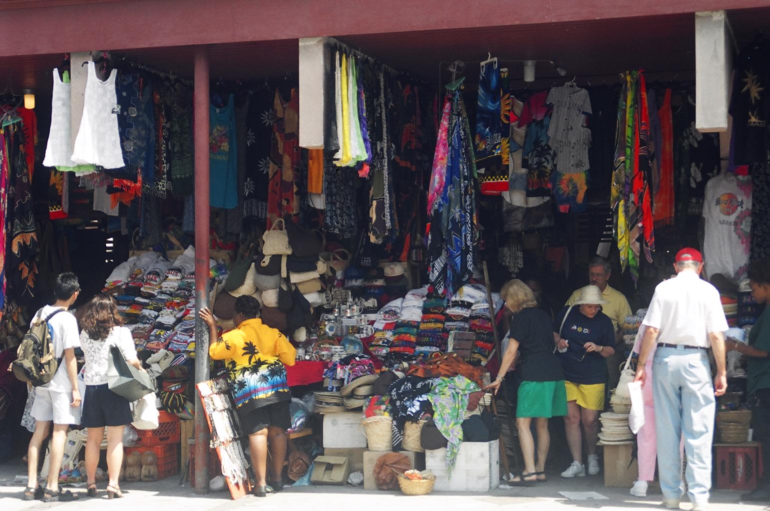
We arrived in Nassau a few days ago and have done a bit of sightseeing, washed down the boat and done a ton of laundry. We have enjoyed shopping with the thousands of cruise boat passengers on Bay St. and at the Straw Market. We spent one evening on Paradise Island at the Casino. I of course lost all of my $20. budgeted for the evening but we did enjoy the sights and sounds.
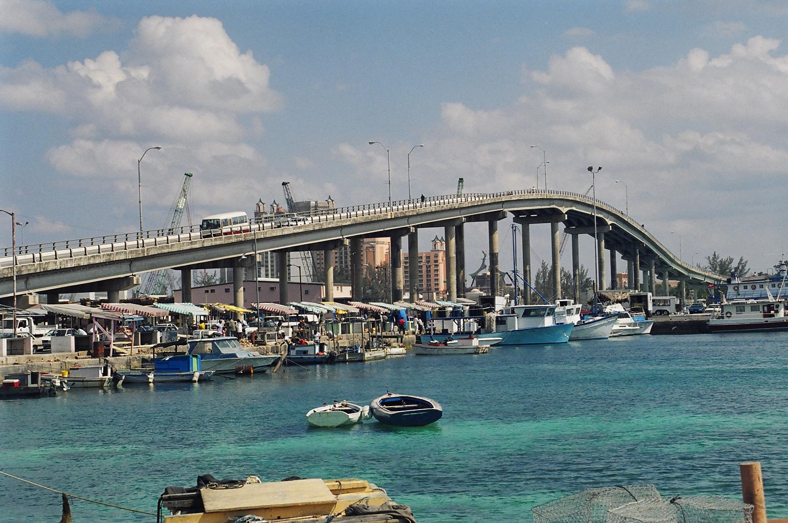 Paradise
Island Bridge and Potters Cay
Paradise
Island Bridge and Potters Cay
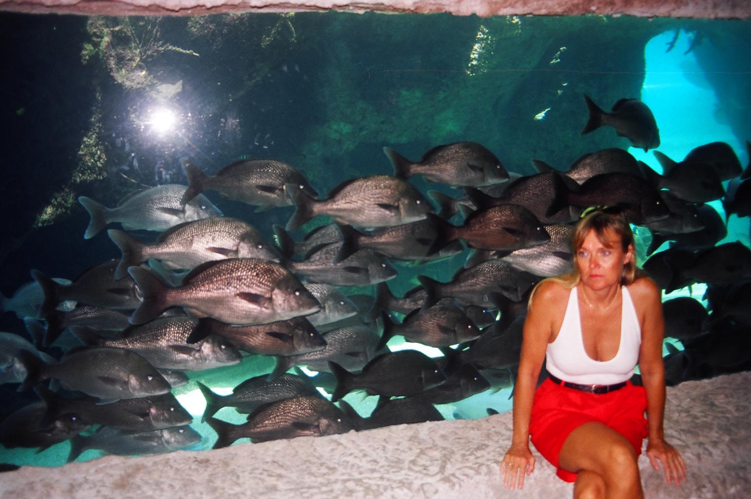
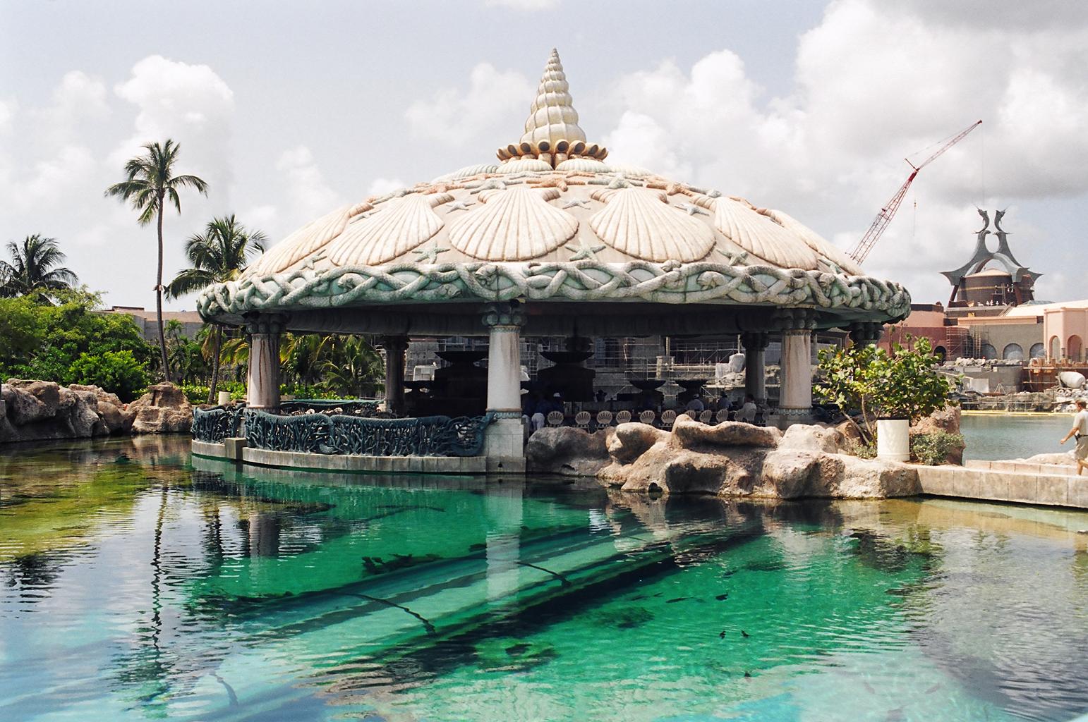
Now, I promised to explain the bath tub comment. Sun International owns two large hotels on Paradise Island known as Atlantis. They are currently building a new Atlantis hotel (at a cost of $450 million US). A part of this incredible complex is the marine/water park. Between the hotel and the Paradise Island beach on the north side of the island, Atlantis features a maze of pools all interwoven with paths, plants, trees and man made waterfalls. There are two swimming pools, a kids pool, water slide and a Lazy river pool that has an artificial current to allow you to just float lazily along the winding river path. Interspersed with the freshwater pools are saltwater pools filled with marine life. Many of the pools have numerous shark and sting rays, some have sea turtles. The larger pools have viewing windows below their water line. The largest even has an underwater tunnel where you can watch as fish, sharks included, swim around and over head as you walk through. One shallow pool looked very much like a windows 95 screen saver, stocked with a school of small rays and a good number of hammerhead sharks. So, for that moonlight swim, I'd hate to dive into the wrong pool. The entire project is due to be finished by yearend and I would certainly consider it for a winter vacation.
 One
of the many views of Atlantis
One
of the many views of Atlantis
 Restaurant
beside the shark pool (notice the underwater tunnel)
Restaurant
beside the shark pool (notice the underwater tunnel)
As I complete this letter, the cold front has passed by us and left cooler air but once again the wind is out of the east. Tomorrow we will leave the marina and anchor in the harbour in preparation for an early start the following day. Our plans from here are to cross the Great Bahama Bank to Bimini then across the Florida Straits to Fort Lauderdale, then head north and home to Ottawa. In Fort Lauderdale we will say goodbye to our friends Ole and Beth as they head home to Denmark. In the two years we have cruised in the Caribbean we have seen and done a lot. We have had the opportunity to explore many of the islands and experience a number of different cultures. Many years ago pirates sailed these same waters in search of gold and silver to fill their treasure chests. For 'Pirate Jenny' and her crew, the treasures we bring home from the Caribbean, are our wonderful memories of the people we've met and the friendships we've made along the way.
Best wishes to all.